Our Services
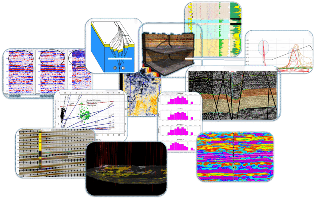
At Cambay Geoscience, we provide integrated subsurface, reservoir, and operational solutions that help energy companies explore smarter, develop fields efficiently, and optimize production with confidence. Alongside oil & gas expertise, we also extend our capabilities into geohydrological and geoengineering domains to support sustainable resource development.
Oil and Gas services
At Cambay Geoscience, we offer integrated oil and gas services that span the entire exploration and production lifecycle. From seismic data interpretation, petrophysical evaluation, and reservoir characterization to geosteering, field development planning, and production optimization, our expertise ensures smarter exploration, efficient development, and sustainable operations. By combining advanced technology with domain knowledge, we help operators reduce risk, maximize recovery, and achieve long-term energy goals.
Seismic data interpretation
we provide specialized seismic data interpretation services designed to resolve complex subsurface challenges. Our expertise lies in analyzing 2D and 3D seismic datasets to unravel intricate structural settings such as faulted basins, thrust belts, salt-influenced provinces, and stratigraphically complex plays. By applying advanced horizon picking, fault interpretation, and seismic attribute analysis, we deliver precise structural and stratigraphic frameworks that reduce exploration uncertainty.
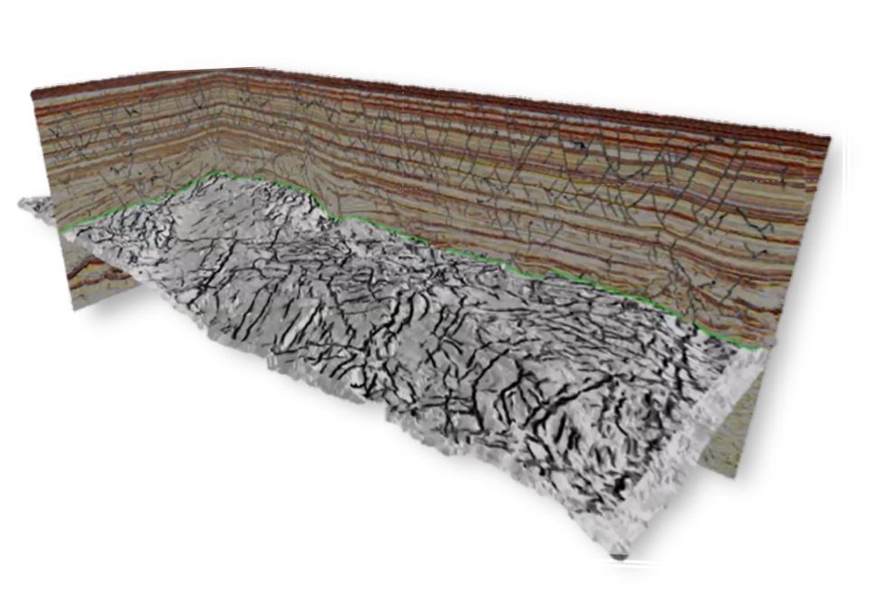
Reservoir Characterization & Inversion Analysis
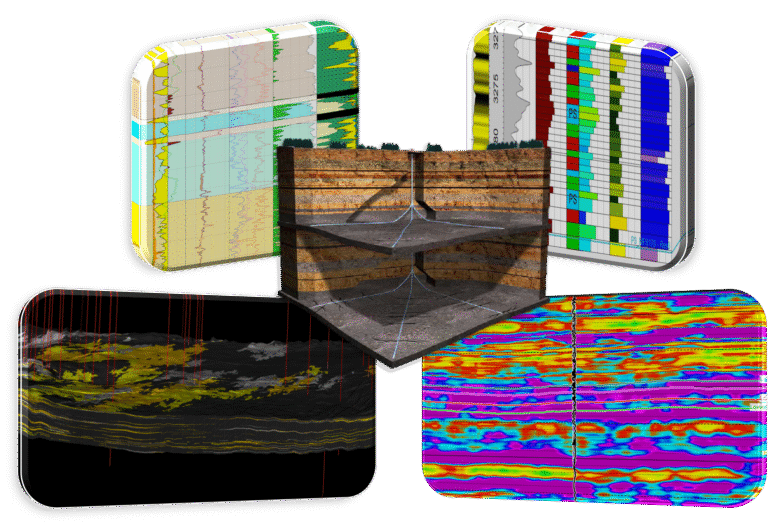
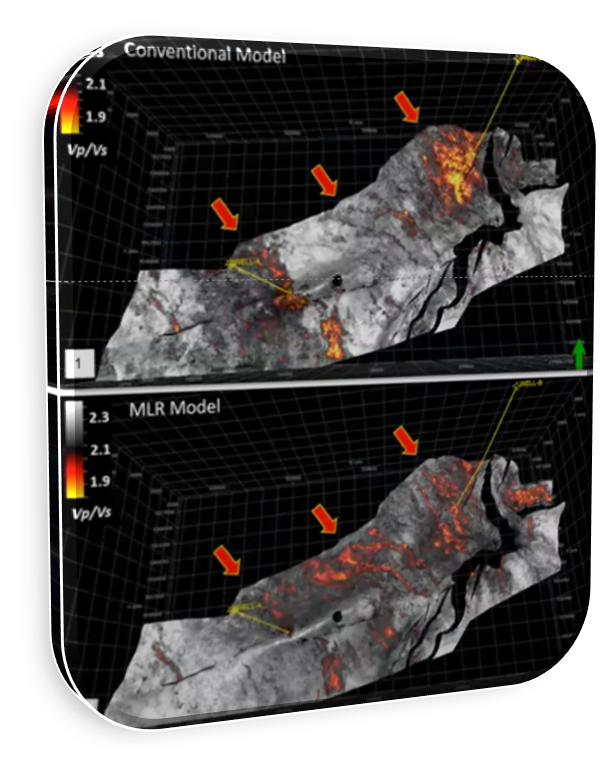
At Cambay Geoscience, reservoir characterization and inversion analysis unlock the hidden potential of seismic and well data, providing clear insights into subsurface properties and reservoir behavior. Our approach integrates seismic attributes, petrophysical data, and rock physics to evaluate lithology, porosity, fluid content, and reservoir continuity with greater accuracy. Through post-stack and pre-stack seismic inversion techniques, we convert seismic amplitudes into quantitative rock property models, enabling a clearer understanding of reservoir heterogeneity and distribution. These results provide operators with reduced uncertainty in prospect evaluation, improved well placement strategies, and optimized field development planning. Whether in clastic or carbonate settings, our reservoir characterization and inversion services help bridge the gap between geophysics, geology, and engineering to maximize hydrocarbon recovery.
Static & Dynamic Reservoir Modeling
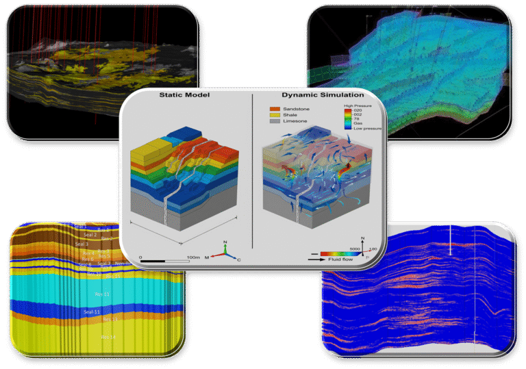
we build robust static and dynamic reservoir models that capture the complexity of the subsurface and support informed decision-making across the field life cycle. Static modeling integrates geological, geophysical, and petrophysical data to construct detailed 3D representations of reservoir architecture, lithology, and properties. Dynamic modeling then brings these models to life by simulating fluid flow and production behavior under varying development scenarios. Together, static and dynamic modeling provide operators with a powerful framework to evaluate reserves, optimize well placement, forecast production, and design efficient recovery strategies. By combining technical rigor with practical field experience, we deliver models that reduce uncertainty and maximize the economic potential of reservoirs.
Petrophysical Evaluation
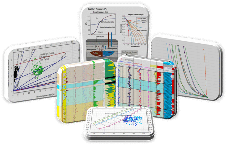
At Cambay Geoscience, Petrophysical evaluation combines conventional well log and core analysis with advanced techniques to deliver a precise understanding of reservoir rock and fluid properties. We assess key parameters such as porosity, permeability, lithology, and hydrocarbon saturation, while applying advanced methods like capillary pressure modeling, NMR log analysis, and spectral gamma-ray interpretation to capture pore structure, fluid behavior, and thin-bed complexities. This integrated approach reduces uncertainty, improves reservoir characterization, and supports confident decision-making in exploration, development, and production
Field Development plan
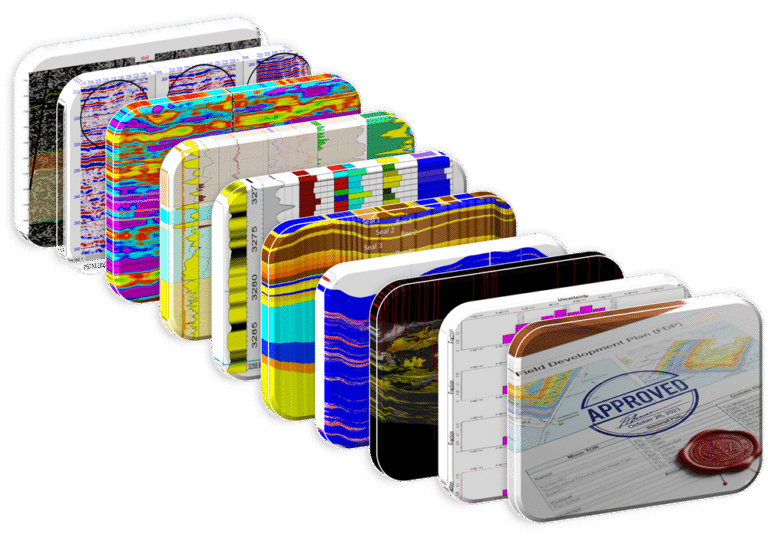
At Cambay Geoscience, we provide complete support in preparing Field Development Plans (FDPs) from concept to regulatory approval. Our team integrates geological, geophysical, petrophysical, and reservoir engineering studies to design optimized development strategies, including well placement, recovery methods, and production forecasting. We ensure every stage—from data evaluation and static & dynamic modeling to economic analysis and documentation—meets industry standards and government requirements, enabling smooth submission and approval
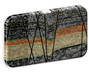
24/7 Geosteering

At Cambay Geoscience, we provide round-the-clock geosteering support to ensure precise wellbore placement and maximum reservoir contact. Our service covers the complete workflow—from well planning and trajectory design to real-time monitoring and steering decisions—helping operators reduce drilling risks and optimize hydrocarbon recovery. We specialize in the interpretation of real-time logs such as azimuthal gamma ray, resistivity, and imaging data, enabling accurate geological correlation and proactive adjustments while drilling. By integrating offset well data with advanced geological models, our experts deliver reliable geosteering guidance throughout drilling operations. With continuous 24/7 support, we ensure that wells are placed safely, efficiently, and in the most productive zones of the reservoir.
Site Restoration & Environmental Stewardship

At Cambay Geoscience, we provide end-to-end solutions for site restoration, including detailed restoration report preparation and environmental stewardship services. Our expertise ensures safe decommissioning, remediation, and land reclamation, supported by thorough documentation that meets regulatory and compliance requirements. We help operators minimize environmental impact and demonstrate long-term commitment to sustainability.
Hydrogeological and Geoengineering services
Groundwater Exploration, Recharging and Assessment & Management

we offer specialized services in groundwater exploration, recharging, and assessment & management to support sustainable water resource development. Using geophysical surveys along with hydrogeological studies, we accurately identify aquifers, map recharge zones, and assess groundwater potential. Our services also include long-term monitoring and management solutions, ensuring reliable supply, regulatory compliance, and responsible use of water resources.
Geoengineering Services

At Cambay Geoscience, our geoengineering services provide critical insights for safe and sustainable infrastructure and energy projects. We specialize in geotechnical investigations, site characterization, foundation studies, slope stability analysis, and risk assessments, helping clients design and execute projects with confidence while minimizing geological hazards.
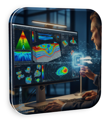
Artificial Intelligence (AI) & Machine Learning
We use Artificial Intelligence (AI) and Machine Learning (ML) to unlock deeper insights from complex subsurface and operational data. Our services include automated well log interpretation, seismic pattern recognition, reservoir property prediction, and production forecasting using advanced data-driven models. AI-driven analytics help in identifying subtle trends, reducing interpretation time, and improving accuracy in exploration and development workflows. We also provide customized ML solutions for drilling optimization, anomaly detection, asset monitoring, and predictive maintenance, enabling operators to enhance efficiency, minimize risk, and lower operational costs. By combining domain expertise with cutting-edge technology, we deliver intelligent solutions that transform data into smarter energy decisions.
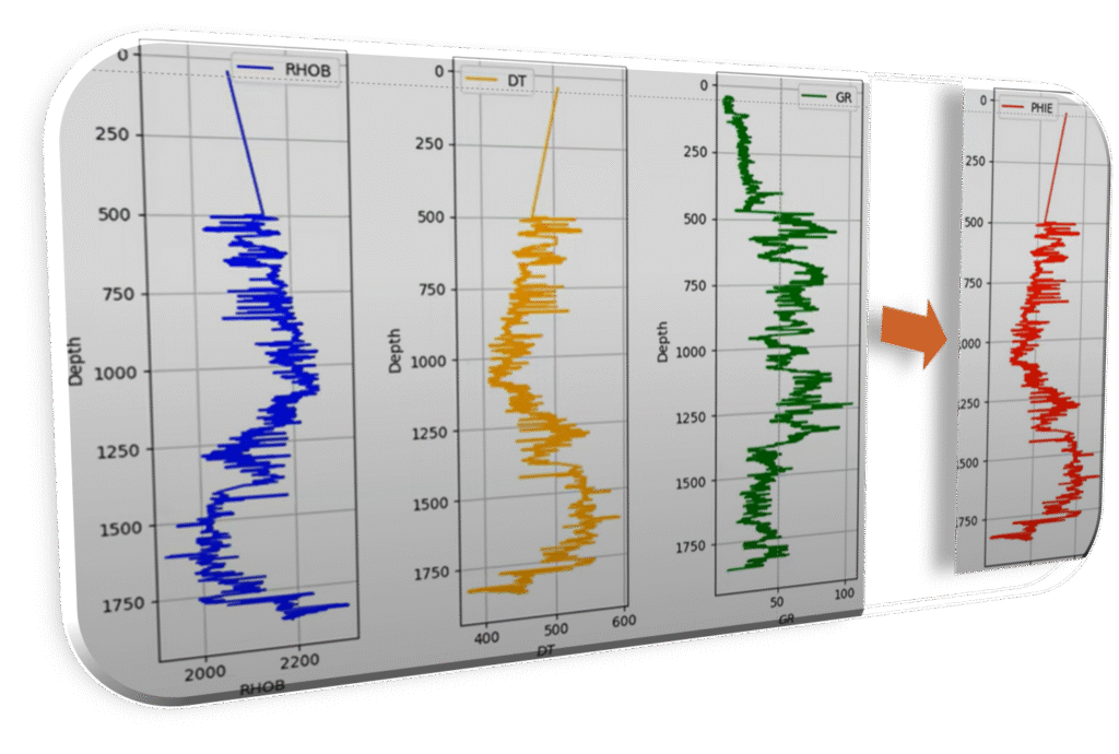
Automated Well Log Interpretation
Fast and accurate lithology, porosity, and saturation predictions using AI models
Seismic Pattern Recognition
Identifying faults, stratigraphic features, and subtle anomalies from large seismic datasets.
Reservoir Characterization & Reservoir Property Prediction
Machine learning workflows to estimate permeability, porosity, and fluid distribution.

Production Forecasting & Drilling Optimization
AI-driven models for decline curve analysis, reservoir performance prediction, and optimization.
Prospect generation and Maturation
Analyzing seismic, well, and geological data with greater accuracy, identify subtle leads, reduce exploration risk, and prioritize the most promising opportunities.

Data management and QC Automation
AI-based tools to clean, validate, and standardize large volumes of subsurface and operational data.
Geographical Information System

At Cambay Geoscience, we provide end-to-end GIS and geospatial solutions that transform raw spatial data into actionable insights. Our services include data conversion and digitization, DEM/DTM generation, geo-referencing, satellite image processing, LiDAR data interpretation, and photogrammetric mapping. We also offer solutions for natural resource management, urban and infrastructure planning, smart-city applications, and network design for utilities. By integrating advanced GIS tools with geoscience expertise, we deliver accurate maps, spatial analytics, and decision-support systems that enhance exploration, environmental monitoring, and sustainable development.
Contact us for more details
- +91 997452253
- business@cambaygeoscience.com
-
Landmark Brushellz, A802/902,
Near Kismat crossroad, Tandalja , Vadodara, Gujarat, India -390012
- Cambay Geoscience
Copyright @ Cambay Geoscience Private Limited | All right reserved